Hovermap selected by Velodyne to showcase lidar mapping capabilities
- Velodyne Lidar, Inc. deploys Emesent’s Hovermap to demonstrate the mapping quality potential of their Puck LITE™ lidar product.
- Hovermap’s unique use of the Puck LITE lidar sensor produces high quality, shadowless point cloud data for customers in mining, forestry, and industrial asset inspection.
- Emesent joins “Automated with Velodyne” integrator program to accelerate innovation and expand lidar mapping and autonomy applications.
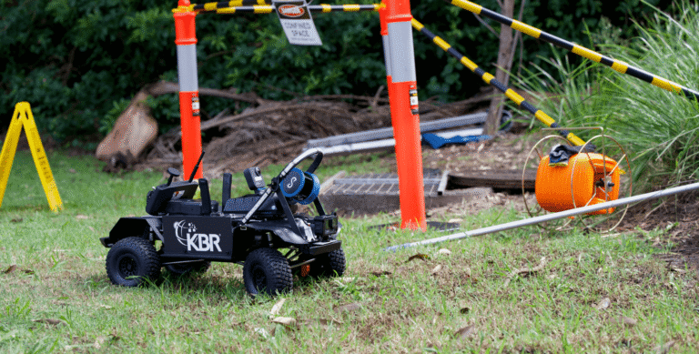
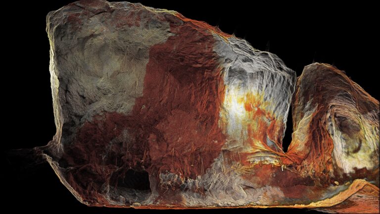
Emesent technology partner, Velodyne Lidar, Inc., uses a Hovermap unit to promote the quality of the point cloud data that can be produced by their Puck LITE™ lidar sensor. Hovermap, a drone autonomy and mapping payload, rotates the sensor to give a 360° x 360° field-of-view, producing shadowless, high-resolution point clouds.
“The Velodyne Puck LITE lidar is simply a sensational sensor for creating mapping solutions because of its compact size, light weight and performance,” explains Dr Stefan Hrabar, Emesent CEO. “The fact that Velodyne is using Hovermap to showcase the mapping performance of their product is testament to the quality of the maps that Hovermap produces.”
“We’ve been extremely impressed with the quality of the point cloud data that Hovermap is able to deliver and how easy it is to use,” said Jon Barad, VP of Business Development at Velodyne Lidar. “We’re now using Hovermap internally to collect showcase datasets and this is helping us to promote the Puck LITE’s mapping potential.”

Velodyne has also recognized Emesent’s unique integration of the Puck LITE into a mapping and autonomy payload through its Automated with Velodyne integrator ecosystem. The program promotes Velodyne’s technology partners, such as Emesent who is at the forefront of using 3D Simultaneous Localization and Mapping (SLAM) algorithms for collision avoidance, navigation and processing lidar data to produce high-resolution, geo-referenced point clouds.

“Emesent’s unique approach is to utilise lidar sensor data, in real time, for collision avoidance and navigation, rather than rely on GPS,” said Dr Stefan Hrabar, Emesent CEO. “Hovermap allows drones to fly in areas without GPS, and then SLAM post-processes the lidar data to produce high resolution point clouds.”
Typically, a UAV requires a GPS signal to monitor its position, but Hovermap removes that limitation with its SLAM and autonomous flight technology. Drone operators and surveyors can now remain in safe, controlled areas while mapping infrastructure in underground, hazardous or GPS-denied environments.
“As a Velodyne partner, we’ve been able to deliver unparalleled levels of positional accuracy, spatial resolution, ease of use and, most importantly, operator safety to our customers,” said Hrabar.
“Hovermap’s integration with the Puck LITE sensor and its 360-degree capture capability are fundamental to our ability to produce high quality, accurate, georeferenced point cloud data when mapping underground mines, forests, or inaccessible infrastructure. Velodyne is a customer-focused technology partner, and Emesent is proud to be part of the Automated with Velodyne program.”
Related Resources